"Geoscience library creation tool QGIS plug-in" is a QGIS plug-in for creating a map for Web geoscience library using QGIS of open software GIS software.
This plug-in started to develop for QGIS 2.12 in 2017, and is now developing the version for QGIS 3.0. When the test is complete, publish the download link below.
QGIS plug-in "Geolib3" Overview
Production environment
- Works with QGIS 3.0 or higher.
- Windows PC (do not tested on Mac, so it may not work.)
- Display size : 1280×1024 or more is recommended. (If the screen size is small, some characters may be hidden)
- Recommend using a mouse.

Function
When you install the "Geolib3" plugin, the following menus and toolbars are added:
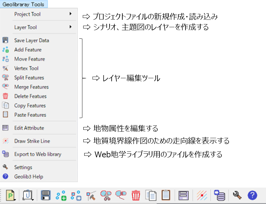
"Geolib3" Plug-in menu and toolbar
You can use the menu or toolbar to do the following:
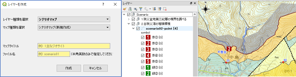
Create Scenario map
You can create scenario maps by freely drawing features such as points (icons), lines and polygons on the map.
Each feature can have a link as a photo or HTML file. In the Web Geoscience Library, this link will pop up when you click a feature.
Create Subject map
you can create subject map layer.
In the current version, two types of subject maps can be created: "geological map" and "hazard map".
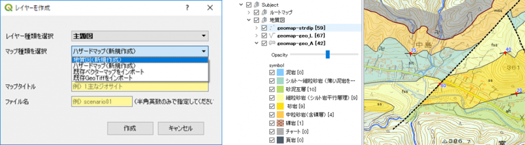
In order to create a geological map, geological boundaries must be drawn using geological topography.
The "Geolib3" plug-in has a function to automatically draw the strike line calculated using the measured strike/dip or 3-point method (use "Draw Strike Line" menu).
Export to "Web Geoscience Library" site
Created scenario maps and subject maps can be exported as a data file processed into a format that can be displayed in the "Web Geoscience Library".