The purpose of this project is that the non-expert of GIS (such as geologist, teacher, student ...) will be able to handle various geospatial data and draw on GIS based on each subjects.
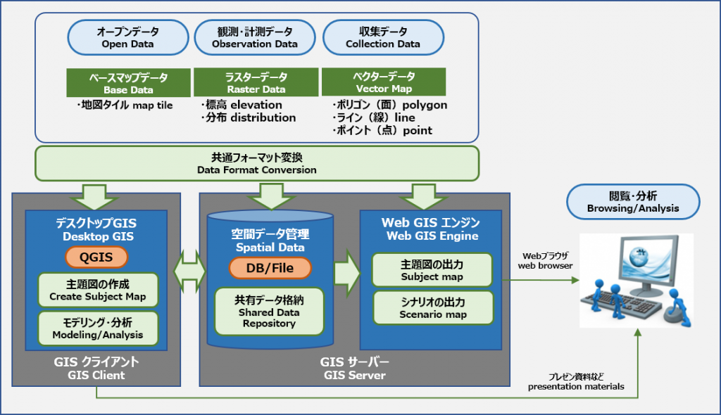
In this project, we use system environment as shown bellow, and use open software products based on FOSS4G.

In progress
Recently with the promotion policy by goverment, various geospatial open data becamoe to share easily in Japan.
In the future, it is expected that geospatial information will be used in various fields such as society, business, education and disaster prevention.
Now, we are carrying out the following projects for the purpose of utilizing geospatial information in the field of science education (especially geoscience education).
- Jun. 2017 - Dec. 2017 : Pilot project for QGIS plugin development
We developed QGIS plugin for drawing tools that support field survey,route map drawing, geological map drawing.
* This project had ended. This plugin program has been taken over to the next project. - Jun. 2018 - : "Web Geoscience Library" web site
・develop a geoscience map web site --"Web Geoscinece Library" -- that can customize by each user.
・develop a QGIS plugin to create maps for "Web Geoscinece Library" that can draw scenario maps and subject maps.